
An Integrated Drone-Borne Magnetics and Multi-Scale Satellite Remote Sensing to Delineate Structural Controls on Groundwater Accumulation in Hard-Rock Aquifers of Ghumnur Khurd surroundings, Komaram Bheem Asifabad Dist., Telangana, India
##plugins.themes.bootstrap3.article.sidebar##
##plugins.themes.bootstrap3.article.main##
Abstract
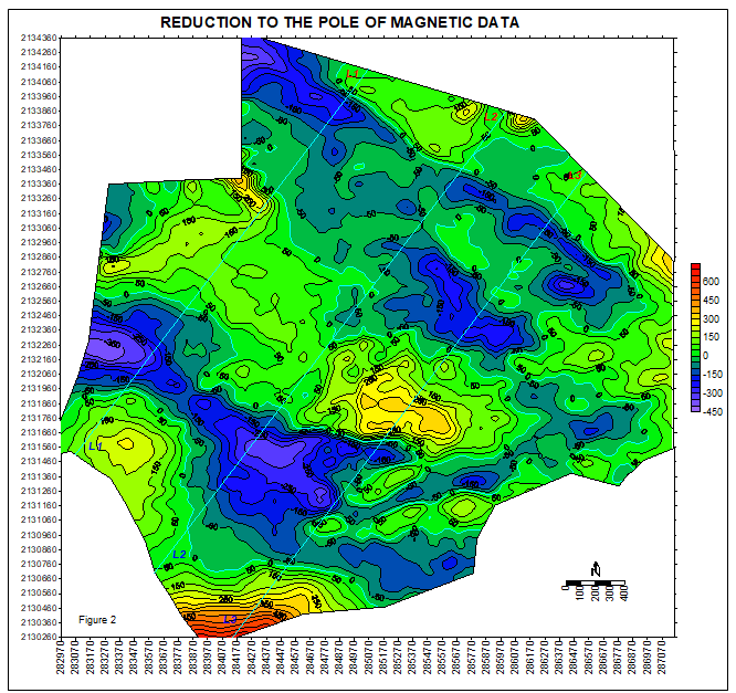
A high-resolution drone-borne magnetic survey was integrated with multi-scale satellite remote sensing over approximately 10 Km2 of tribal agricultural land in Komaram Bheem Asifabad district, northern Telangana, India, to identify subsurface dolerite dykes and assess their potential as natural barriers for passive groundwater storage. A total of 23,432 magnetic readings were acquired at 10Hz using a UAV- mounted proton precession magnetometer at a mean altitude of 581m amsl. Total Magnetic Intensity (TMI) data were processed to generate residual anomaly, Reduction to Pole (RTP), and Analytic Signal maps. Three distinct dolerite dykes were delineated: two NW–SE trending bodies (Dyke A: +949nT; Dyke 2: +160nT) and one NE–SW cross-cutting lateral barrier (Dyke 3: +198nT). Dip directions and geometries were determined using the North–South magnetic gradient asymmetry method and independently validated by satellite terrain slope, geomorphology, and lineament density maps. Both NW–SE dykes dip northward at 650–80°, directly opposing the regional NNE → SSW groundwater flow, creating highly effective natural subsurface dams. Peters’ half-width depth estimates place the top of the dyke intrusions at 30–55m, with basement depths varying between 75m and 134m along three modelled depth profiles. Total passive groundwater storage potential is estimated at 8.3 million litres, which scales to 11.1 million litres with targeted surface check dam integration. Eight priority borewell locations and five surface check dam sites are proposed to enhance community water security. Published regional data indicate acceptable water quality for drinking and irrigation; however, mandatory fluoride testing is required at each borehole prior to commissioning due to localized geogenic risks. This study demonstrates that integrated drone magnetic workflows, cross-validated by multi-band satellite imagery and digital terrain layers; provide a rapid, non-invasive, and cost-effective paradigm for groundwater resource exploration in complex hard-rock aquifers.